

Case work
Neithorpe BridgeBridge 161, Oxford Canal
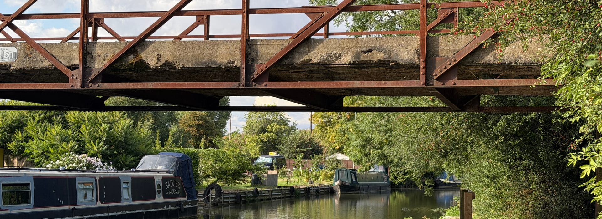
An iron bridge once associated with the Alcan Works (locally known as the Ally), where the aluminium was rolled for the Spitfire during WW2, is under threat of demolition. Canal & River Trust has applied to remove Bridge 161 — a structure that has served this community for generations and forms an integral part of the Banbury Fringe Walk.
About the bridge
An iron footbridge under threat
Neithorpe Bridge — formally designated Bridge 161 on the Oxford Canal — is a riveted iron lattice footbridge with concrete decking, located in the Neithrop area of Banbury. It carries a permitted way across the Oxford Canal and forms part of the canal towpath network that runs through the town.
The bridge provides an important pedestrian link between Neithrop and the wider canal towpath, connecting residents to the town centre and to open green space along the waterway. It is also an integral part of the Banbury Fringe Walk — a well-used circular walking route around the town — making its loss significant not just for local residents but for the wider walking community.
Canal & River Trust, which owns and is responsible for maintaining the bridge, has submitted a planning application to Cherwell District Council seeking permission to demolish it. The Trust's position is that the structure has deteriorated to the point where it is no longer safe and that repair is not economically viable. Residents and local groups strongly dispute that demolition is the only or best option.
Key facts
- Bridge number: 161, Oxford Canal
- Type: Riveted iron lattice footbridge with concrete decking
- Location: Neithrop, Banbury, Oxfordshire
- Owner: Canal & River Trust
- Status: Demolition application submitted
- Planning authority: Cherwell District Council
Banbury Fringe Walk
An integral part of a well-loved walking route
The Banbury Fringe Walk is a circular walking route that takes in the green spaces, waterways, and open land on the fringes of the town. Bridge 161 is not a peripheral feature of this route — it is an integral crossing point without which the walk cannot be completed as intended.
Demolition of the bridge would sever the Fringe Walk at this point, forcing walkers onto a lengthy road diversion and fundamentally altering the character of the route. For many residents — including older people and families with children — the Fringe Walk is a valued part of daily life in Banbury. Its integrity matters.
Canal & River Trust should be required to demonstrate that any replacement or alternative crossing is provided before demolition is permitted, not as an afterthought. The Fringe Walk leaflet, available below, shows clearly how the route depends on this crossing.
Download the Banbury Fringe Walk leaflet
The official Banbury Fringe Walk leaflet shows the full route and illustrates the role Bridge 161 plays as a key crossing point on the walk.
Banbury Fringe Walk leaflet (PDF)Location
Where is Neithorpe Bridge?
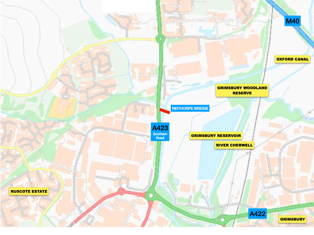

Scan this location to open in maps on your phone
OS National Grid Reference
SP 45583 42352
What Three Words
///adopt.many.zipsDecimal Coordinates
1.33627642748225° W
52.077652884358° N
Condition
The case for and against demolition
Canal & River Trust's position
The Trust has stated that Bridge 161 has deteriorated significantly and that the cost of repair or replacement is not justified given the availability of alternative crossings nearby. However, they don't take into account the route of the Banbury Fringe Circular Walk, which was established around 30 years ago. The walk guides walkers away from busy roads such as Southam Road.
Community concerns
Residents and local groups dispute that demolition is the only option. They argue that the bridge is a valued community asset, that its loss would sever the Banbury Fringe Walk, and that Canal & River Trust has a responsibility to explore repair, reconstruction, or replacement before resorting to permanent removal.
Maintenance history
Questions have been raised about whether the bridge was adequately maintained over the years and whether earlier intervention could have prevented the current situation. Canal & River Trust should be transparent about the maintenance record of this structure.
Right of way or permitted access?
At very least the bridge carries a footpath with permitted access, although it could be argued that the route should be a 'right of way'.
Planning application
The application to demolish
Canal & River Trust has submitted a planning application to Cherwell District Council seeking permission to demolish Bridge 161. The Trust's position is that the bridge is no longer safe and that the cost of repair or replacement is not economically justified.
The application has prompted concern among residents, Fringe Walk users, and local groups. Critics argue that demolition without replacement would permanently sever a public right of way (the Canal Towpath) from the Banbury Fringe Walk and put at risk a community asset. The Trust has a duty to explore all options before resorting to permanent removal.
The planning process provides an opportunity for the community to have its say. Cherwell District Council will consider representations from residents and other stakeholders before reaching a decision.
Stop Press!
Councillor Ian Harwood has pointed out to planning officers that the application is not one that can be regarded as a permitted development. So the planning clock will be reset and the application will be considered properly.
What happens next
- 1Assignment: Once a planning application is validated, it is assigned to a specific planning officer within the department.
- 2Consultation: The officer reviews technical constraints, consults statutory bodies, neighbour notifications, and local parish councils, and reviews public feedback.
- 3Assessment: The officer evaluates the proposal against national planning frameworks and the local development plan.
- 4Decision: Rather than going to a public committee meeting, the officer drafts a written report and exercises delegated powers to issue the final approval or refusal notice.
Safety & Community
Antisocial behaviour and criminal activity at the site
Paul-Austin has been approached by residents who live adjacent to the site who report antisocial behaviour which has at times been aggressive. The site is also used by people at night-time engaging in alleged criminal activity.
The people that live next to Neithorpe Bridge should be able to expect to live in a safe environment, like any other resident of Banbury.
My position
What I am doing about this
I am monitoring this planning application closely as the bridge is in the electoral division that I represent. I will be making representations on behalf of residents in the Banbury Grimsbury & Castle electoral division. Bridge 161 is part of the fabric of this community and an integral part of the Banbury Fringe Walk. Its loss would be permanent, and it may not be that demolition is the only solution. There is no reference to the formalised Banbury Fringe Walk in the Trust's application to demolish. They do however acknowledge that the bridge is used by pedestrians, implying permitted rights. It may be that a formal right of way is required at the site.
I am pressing for the Canal & River Trust to demonstrate that all alternatives have been properly assessed — including repair, reconstruction, and the provision of a replacement footbridge — and to be transparent about the maintenance history of the structure. If the bridge has been allowed to deteriorate through inadequate upkeep, that is a matter of public concern.
I have asked County Council Officers to look at the status of the footpath across the bridge in relation to the Banbury Fringe Walk. Is it possible to confer Public Right of Way designation? The Canal & River Trust acknowledge that the bridge is used by pedestrians. I've also asked for physical restrictions to be put in place to prevent vehicular access to the unsafe structure.
I have written to the area commander at Thames Valley Police detailing concerns about antisocial and aggressive behaviour at the site, as well as alleged criminal activity.
I would encourage all residents who use this bridge or the Banbury Fringe Walk to submit comments to Cherwell District Council during the public consultation period. Likewise, if you oppose the retention or replacement of the bridge at this site, contact the Cherwell District Council planners. Your voice matters in this process.
Contact me about this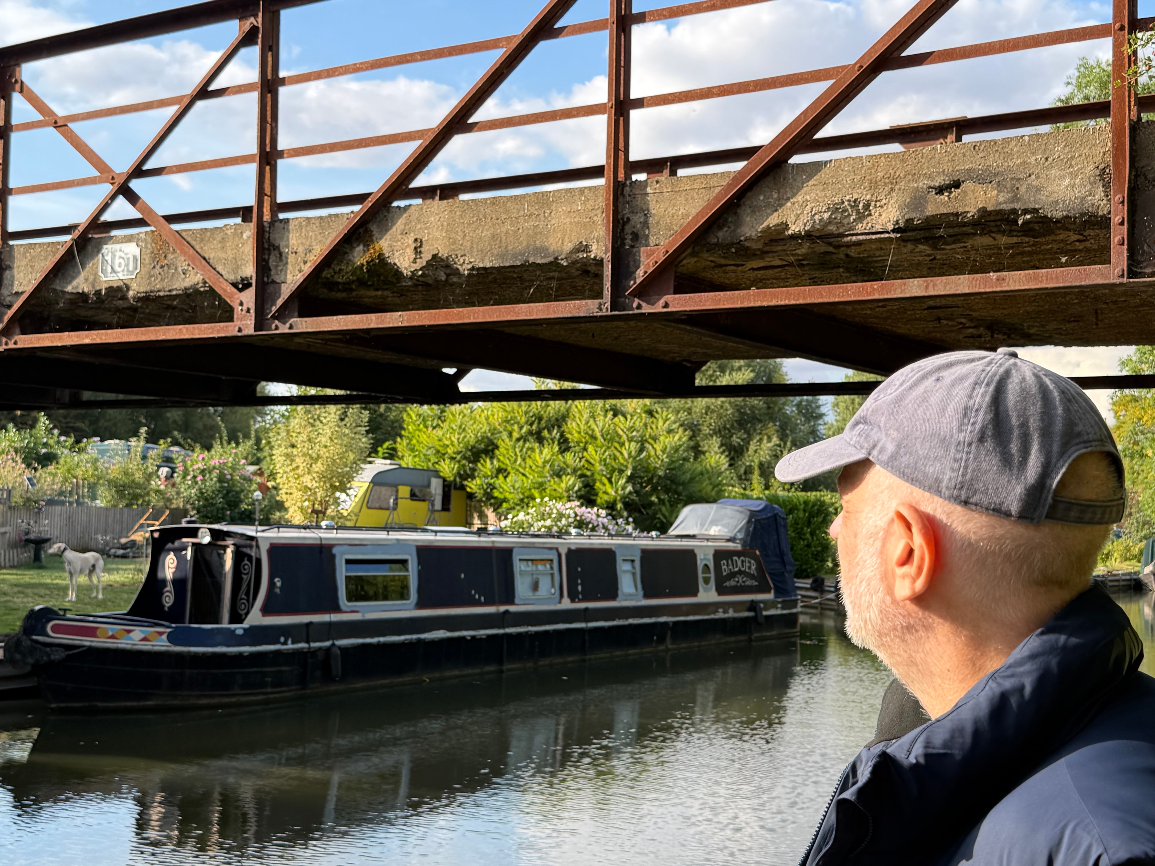
Campaign
The Banbury Greenway
The Banbury Greenway is a proposed strategic green corridor linking the town's existing open spaces, canal towpath, and surrounding countryside into a coherent, accessible network for walking, cycling, and nature. The vision sets out a connected route from the Oxford Canal through Grimsbury, threading together parks, community green spaces, and wildlife habitats to create a living landscape that serves both people and biodiversity. It would provide residents with safe, traffic-free routes for everyday journeys and leisure, while strengthening ecological connectivity across the division.
The Greenway sets out an ambition for the towpath corridor and complements the Forest of Banbury prospectus by creating the active travel spine that new tree planting and habitat restoration can grow along. Paul-Austin sees the Greenway as an essential part of making Banbury a more resilient, healthier, and more attractive place to live — one where the natural environment is woven into the fabric of the town rather than pushed to its edges.
Read the prospectus
Download the full Banbury Greenway Prospectus to find out more about the vision and proposals.